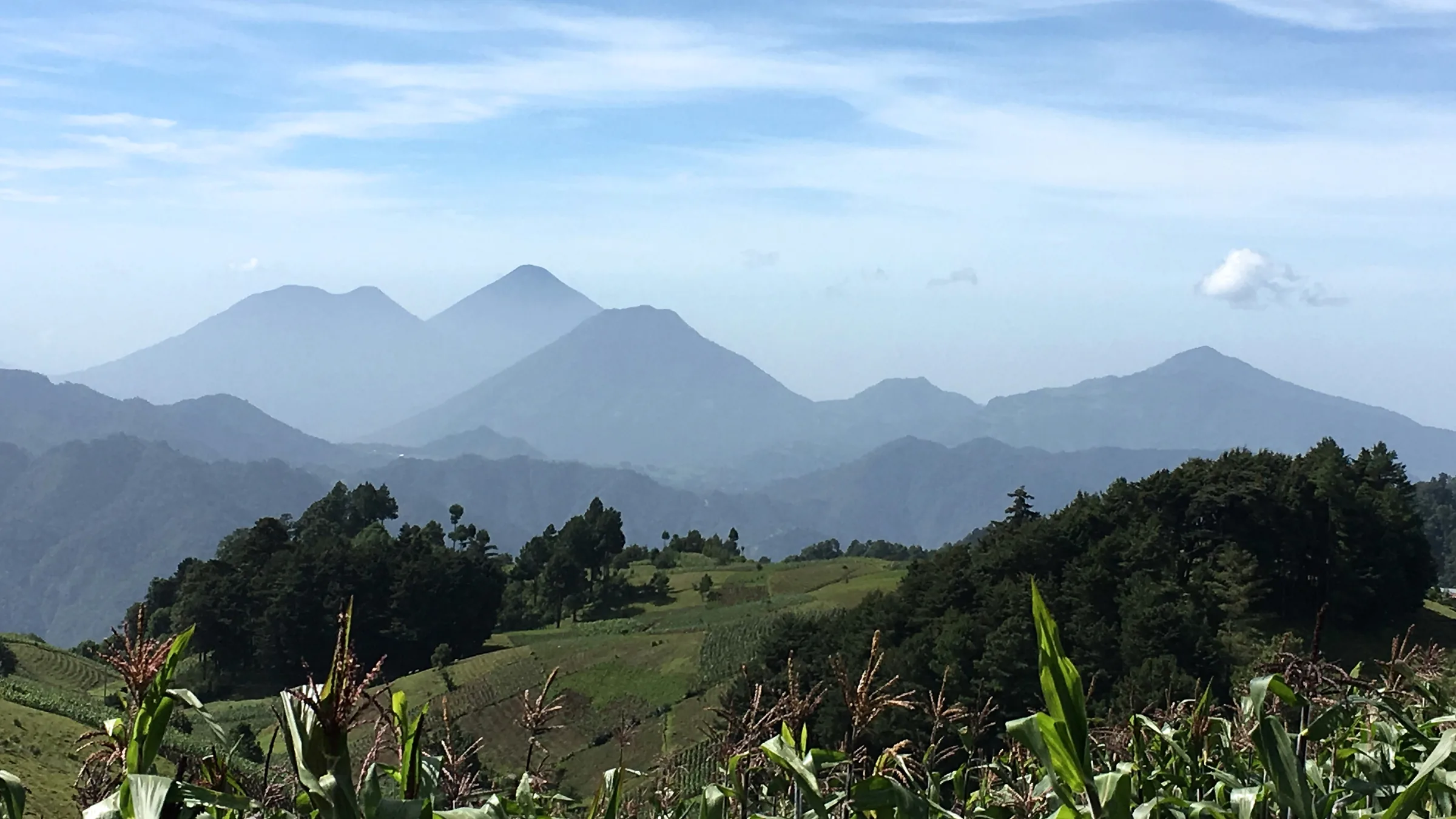
Layers of mountains and a green slope with crops in the foreground.

Quetzaltenango

Santa María volcano, Chicabal lake, Fuentes Georginas, Xela and Salcajá

Before you go, understand the place.

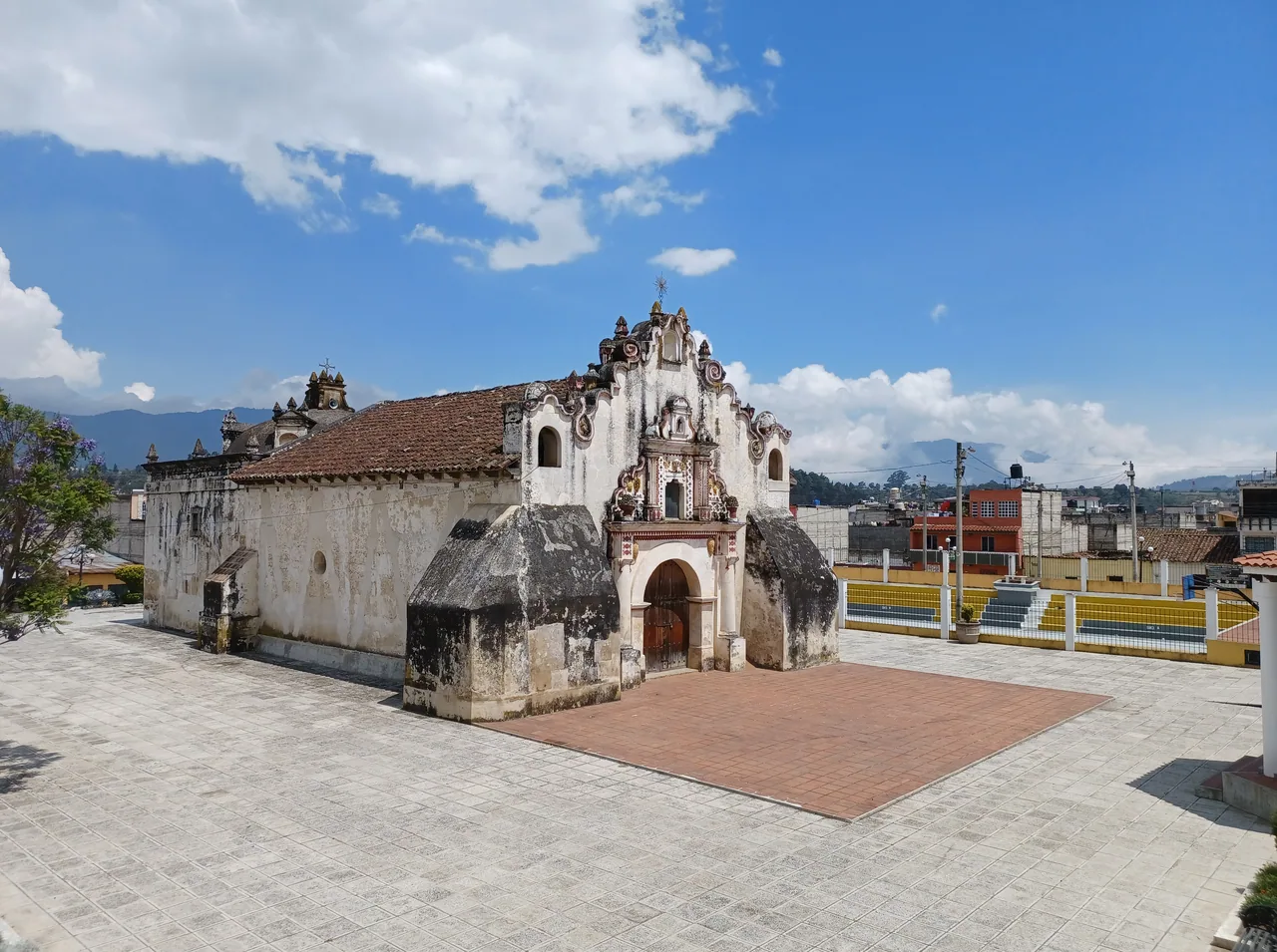
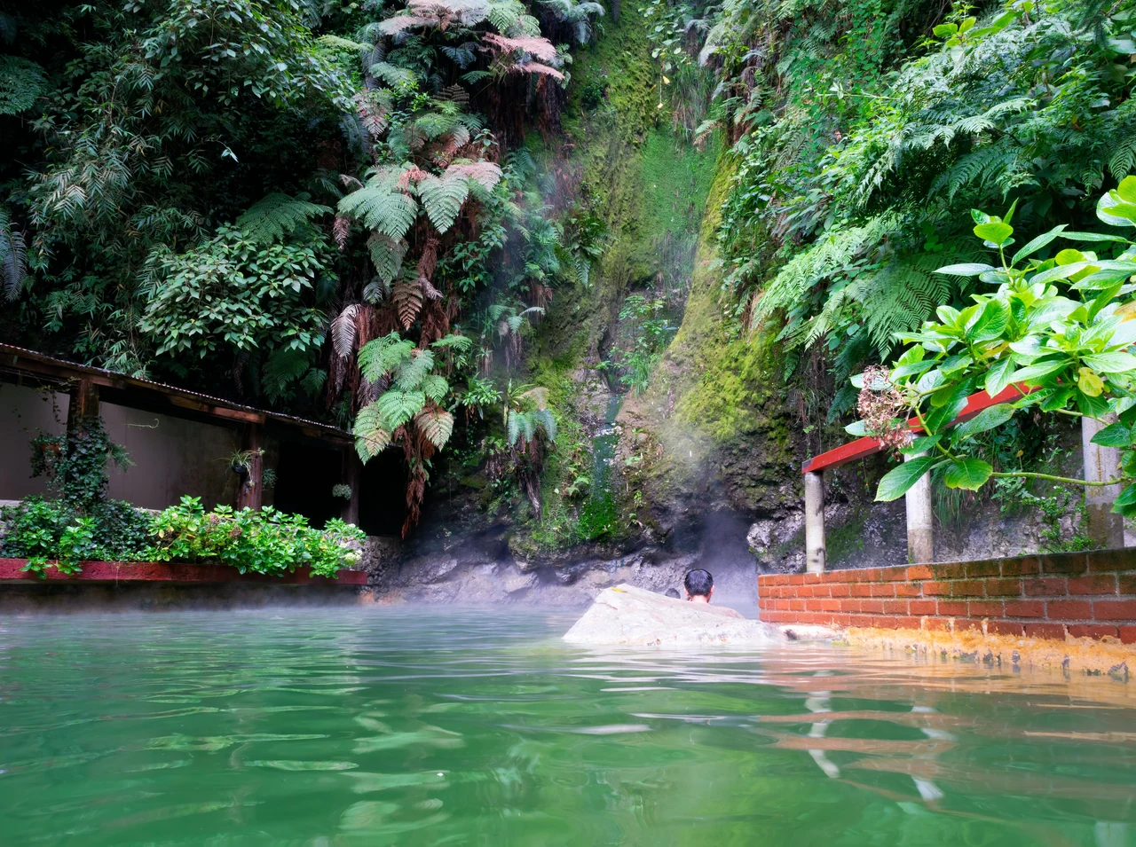
Quetzaltenango (Xela) has the Natural History Museum, in the Casa de la Cultura de Occidente. The Fuentes Georginas hot springs are in Zunil.

Themed guides

Places grouped by theme, to plan your day.

  • Volcanoes and lakes

    Santa María volcano and Chicabal lake have unconfirmed status. INSIVUMEH's bulletin of 3 October 2026 keeps the ban on going within 5 km of the Santiaguito domes; the Santa María summit is about 2.5 km from the Santiaguito point it publishes, and whether the climb is permitted has not been confirmed.

    Open the full guide
  • Xela and Zunil

    The Natural History Museum is in central Quetzaltenango, and Fuentes Georginas is in Zunil. Their hours and fees are unconfirmed.

    Open the full guide

Plan your visit

The practical information you need to plan your visit

The essentials

Best time to go
According to the United Kingdom, the rainy season normally runs from May to November, with frequent flooding and landslides; poorly maintained roads and bridges have been known to collapse.
Getting there
According to CONAP, the Santa María climb starts from Llanos del Pinal and the El Polígono estate, although whether it is permitted has not been confirmed (see the tips); Chicabal lake is 25 km from Xela plus 5 km of dirt road.
  1. Chicabal lake and its stepped trail
  2. The Fuentes Georginas hot springs

Where to stay

Central Quetzaltenango
According to the US Department of State, tourist assistance (ASISTUR) works with the tourist police in areas such as Quetzaltenango.
Zunil
The town on the way to Fuentes Georginas; Living in Guatemala (August 2026) warns that the road has failed in the rain.

Tips and precautions

  1. The mapped Santa María summit is about 2.5 km from the Santiaguito point published in INSIVUMEH's 3 October 2026 bulletin. That bulletin calls for a 5 km restriction around the domes to remain in place. How it applies to the Santa María climb, and whether that climb is permitted, has not been confirmed. Going with a guide does not authorise entering the restricted area.
  2. At Chicabal lake, guatemala.com (2025) says swimming is forbidden and camping is allowed only in marked areas.
  3. Fuentes Georginas takes cash only, according to Living in Guatemala (August 2026).

Safety and precautions

  • According to the United Kingdom (advice current on 3 October 2026), Guatemala has one of the highest violent crime rates in Latin America, and incidents can also happen in tourist areas.
  • The guide focuses on Quetzaltenango and its surroundings: Huehuetenango is under travel advisories from several governments, listed under “Safety and precautions”.
  • The United Kingdom advises against all but essential travel within 5 km of the Mexican border, from the Pacific coast up to the Gracias a Dios crossing, and to Santa Ana Huista, San Antonio Huista and La Democracia (Huehuetenango). Spain rates the departments of San Marcos and Huehuetenango as high risk because of organised crime.
  • The US Department of State advises reconsidering travel to Guatemala because of crime and terrorism (level 3, advisory issued on 12 March 2026). It advises against travel to the departments of San Marcos and Huehuetenango, zone 18 of Guatemala City and Villa Nueva (level 4).
  • Spain (update of 8 May 2026) lists among the risk areas to avoid zones 3, 5, 6, 7, 8, 11, 12 and 18 of Guatemala City, Villa Nueva and Mixco, and the departments of San Marcos, Huehuetenango, Escuintla, Petén and Izabal. It rates the rest of the country as medium risk and warns that there are no completely safe areas.
  • Before climbing a volcano, the United Kingdom advises checking with INSIVUMEH and CONRED: there is no mountain rescue service and local organisers tend to underestimate the risks. Spain reports occasional robberies on the climbs of Pacaya, Santa María and Agua, and recommends doing them in a group, by day and with a professional guide.
  • According to the Ministry of the Interior, a 15-day state of prevention came into force on 21 April 2026 in the departments of Guatemala, Escuintla, Izabal, San Marcos and Huehuetenango (Government Decree 6-2026). Whether one is in force now is unconfirmed.
  • INGUAT tourist assistance: 1500, free and 24 hours. National Civil Police: 110 and 120.

Frequently asked questions

Why are there no places in Huehuetenango?

The guide focuses on Quetzaltenango and its surroundings: Huehuetenango is under travel advisories from several governments, listed under “Safety and precautions”.

What restriction applies at Santiaguito?

INSIVUMEH's daily volcano bulletin of 3 October 2026 asks that the ban on entering the 5 km area around its domes be kept, under record 141-2024 of the Municipality of Quetzaltenango. CONAP lists the Manhermans viewpoint and recommends a certified guide, but neither a listing nor a guide authorises entering a restricted area, and current permission for that visit is unconfirmed. Based on the published points, the Santa María summit is about 2.5 km from the bulletin's Santiaguito point; how the restriction applies to that climb has not been confirmed.

How much is Fuentes Georginas?

Q60 for foreign visitors and Q40 for Guatemalans, according to the Ministry of Culture's directory; unconfirmed by the resort.

Sources

Information checked in . Prices, hours and rules change: confirm them with the official source before you travel.

  1. CONAP – Zona de veda definitiva Volcán Santa María2026
  2. CONAP – Volcán Santiaguito y mirador Manhermans2026
  3. INSIVUMEH – Boletín vulcanológico diario (3 oct. 2026)2026
  4. ASAECO – Laguna de Chicabal2026
  5. CONAP – Zona de veda definitiva Volcán Chicabal2026
  6. SIC (Ministerio de Cultura) – Fuentes Georginas2026
  7. Living in Guatemala – Fuentes Georginas (24 ago. 2026)2026
  8. FCDO (Reino Unido) – Guatemala: regional risks (13 ago. 2026)2026
  9. Gobierno de España – Recomendaciones de viaje: Guatemala (8 may. 2026)2026
  10. FCDO (Reino Unido) – Guatemala: safety and security (13 ago. 2026)2026
  11. U.S. Department of State – Guatemala Travel Advisory (12 mar. 2026)2026
  12. Ministerio de Gobernación – Nuevo estado de prevención (21 abr. 2026)2026
  13. INGUAT – Asistencia al Turista 15002026

Everything you can do

Closed or restricted places are included and flagged, so you know what to expect.

Showing 5 of 5 · 5 unconfirmed, flagged

Nature and jungle · 2

  • Chicabal lake

    NatureStatus unconfirmed

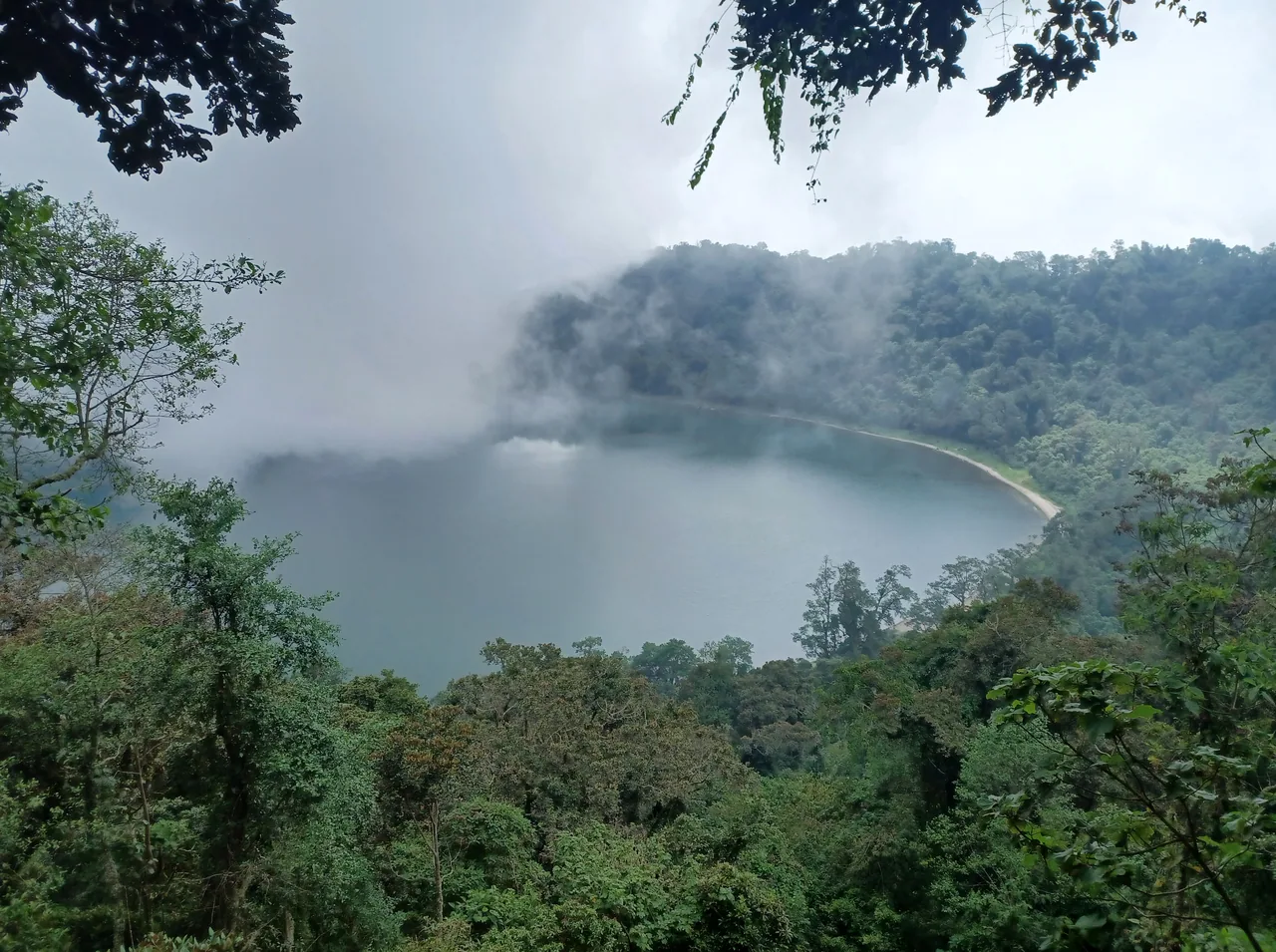
    The lake of Chicabal volcano, at 2,712 m, in San Martín Sacatepéquez. For the Mam Maya worldview it is one of the most important sacred sites: every year, 40 days after Holy Week, the Rain Petition is held there, according to the ASAECO association.

    Status unconfirmed: according to its website, ASAECO runs the volcano and the lake; CONAP's listing names CONAP as administrator and says ASAECO handles the activities. Neither gives a fee, and whether the hours still apply is unconfirmed.

    Practical details and sources
    Entry
    guatemala.com (June 2025) gave foreign visitors Q75, Guatemalans Q20, children Q10, parking Q20 and camping Q20. Unconfirmed by the administration.
    Hours
    Monday to Sunday, 9:00 a.m. to 4:00 p.m., according to CONAP.
    Source
    ASAECO – Laguna de Chicabal · 2026 · +2

    Tip: According to ASAECO, a trail leads from the visitor centre to a viewpoint and then 570 steps go down to the shore; another 1.8 km trail circles the lake. guatemala.com (2025) says swimming is forbidden because the lake is sacred.

    Nearby: Santa María volcano (11.7 km)

    Sources: ASAECO – Laguna de Chicabal · CONAP – Zona de veda definitiva Volcán Chicabal · guatemala.com – Volcán y laguna Chicabal (27 jun. 2025)

    San Martín Sacatepéquez, Quetzaltenango. According to ASAECO, the «Laguna Seca» visitor centre is 3 km up a dirt road from the hamlet of Toj Mech. The pin is the lake in OpenStreetMap, linked to Wikidata; it is not the entrance.11 km in a straight line from the regional map centre

  • Santa María volcano

    AdventureStatus unconfirmed

    A volcano south of Quetzaltenango that, according to CONAP, is run by CONAP and the Municipality of Quetzaltenango. CONAP describes a 2.5 to 5 hour climb from the El Polígono estate, but how the 5 km restriction around the Santiaguito domes applies to it has not been confirmed. At its foot is the Santiaguito dome complex, whose Caliente dome is active according to CONAP.

    Status unconfirmed by CONAP and the Municipality. The mapped Santa María summit is about 2.5 km from the Santiaguito point published in INSIVUMEH's daily volcano bulletin of 3 October 2026. That bulletin calls for a 5 km restriction around the domes to remain in place, under record 141-2024 of the Municipality of Quetzaltenango. How it applies to the Santa María climb, and whether that climb is permitted, is unconfirmed. Spain reports occasional robberies on the Santa María climb (update of 8 May 2026).

    Practical details and sources
    Hours
    Whether the climb is permitted has not been confirmed: the summit point is about 2.5 km from the Santiaguito point in INSIVUMEH's 3 October 2026 bulletin, which calls for a 5 km restriction around the domes to remain in place. For the park, CONAP gives Monday to Sunday, 9:00 a.m. to 4:00 p.m.

    Nearby: Fuentes Georginas (7.9 km) · Víctor Salvador de León Toledo Natural History Museum (9.2 km) · Chicabal lake (11.7 km)

    Sources: CONAP – Zona de veda definitiva Volcán Santa María · CONAP – Volcán Santiaguito y mirador Manhermans · INSIVUMEH – Boletín vulcanológico diario (3 oct. 2026) · Gobierno de España – Recomendaciones de viaje: Guatemala (8 may. 2026)

    Llanos del Pinal, Quetzaltenango. The pin is the volcano's summit in OpenStreetMap, linked to its Wikidata entry; it is not the start of the climb. The Manhermans viewpoint over Santiaguito has no pin of its own.6.5 km in a straight line from the regional map centre

Volcano and mountain · 1

Living culture · 2

Keep exploring Guatemala